Parks and trails
Parks and trails near Rock Ridge
A neighborhood park is two tenths of a mile away, and the hike with the best view in the city is under three. Distances are by road from the gate, with the agencies that run each park named.
The neighborhood parks
Patterson Park is 0.2 mile from the gate, the closest green space, with Bobby Bonds Park 0.8 mile and Bordwell Park 1.2 miles, all run by the City of Riverside. They are the everyday walk, the after-work loop and the place to take the dog, which the pet page covers.
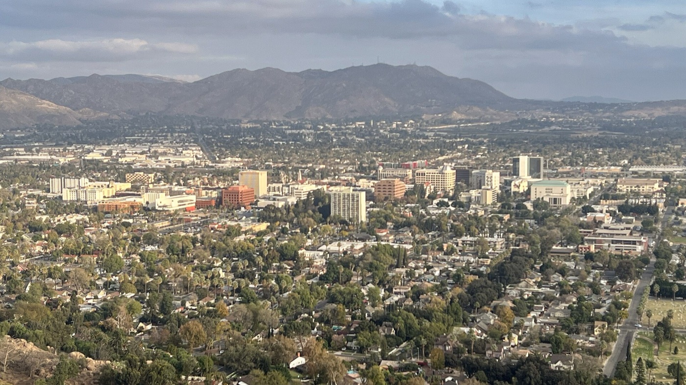
Mount Rubidoux
Mount Rubidoux is 2.7 miles away, a City of Riverside memorial park with a paved pedestrian trail that climbs to a summit holding the Serra Cross and the Peace Tower. The view over downtown and the valley is the reason people go. It is a walkers-and-runners hill; cars stay at the bottom.
The bigger open space
Sycamore Canyon Wilderness Park, about 3.0 miles, is a City of Riverside wilderness park with a network of hiking trails. The Box Springs Mountain Reserve, run by Riverside County, is 10.3 miles out by the entrance road, with the concrete C that overlooks the UC Riverside campus. The UCR Botanic Gardens, 3.3 miles, cover about 40 acres in the hillside at the edge of campus and are open to the public.
Rock Ridge is mostly one-bedroom homes, each a single level with nobody above or below, plus a two-bedroom and three-bedrooms upstairs over the garages. One-bedrooms are listed from $1,595/month right now. Every open home and its exact rent is on the availability page.
Questions people ask
What parks are near Rock Ridge?
Patterson Park (0.2 mile), Bobby Bonds Park (0.8) and Bordwell Park (1.2), all City of Riverside parks. Mount Rubidoux is 2.7 miles.
Where is the best hike near Rock Ridge?
Mount Rubidoux, 2.7 miles away, a city park with a paved trail to a summit with the Serra Cross and the Peace Tower and a view over downtown Riverside.
Is there a botanic garden nearby?
The UCR Botanic Gardens, about 40 acres at the edge of the UC Riverside campus, are 3.3 miles from the gate and open to the public.
Are there bigger trails for a longer hike?
Sycamore Canyon Wilderness Park, a City of Riverside wilderness park, is about 3.0 miles, and the Box Springs Mountain Reserve, run by Riverside County, is 10.3 miles by the entrance road.
Distances measured by road from 3581 Chicago Ave using OpenStreetMap, October 2026. Park facts from the City of Riverside, Riverside County Regional Park and Open-Space District, and UC Riverside.
More about living here
- Moving to Riverside, California
- Downtown Riverside and the Mission Inn
- Coffee and food near Rock Ridge
- Groceries and everyday errands near Rock Ridge
- Things to do in Riverside
- Commuting from Rock Ridge
- The courtyard pool at Rock Ridge
- A single-level home with nobody above or below
- An apartment with a patio of your own
- Private garages for rent
- Working from home at Rock Ridge
- The neighborhood guide
- All questions